Tracking Wolf Movements to Improve Boreal Caribou Habitat Management Planning
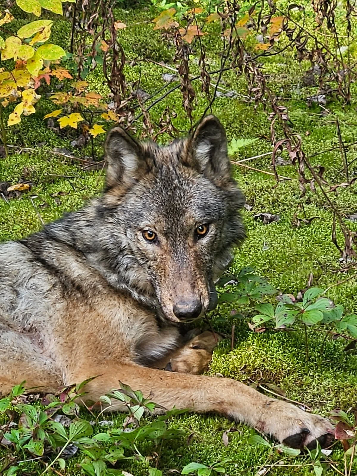
The Boreal Caribou Habitat Restoration and Wolf Movement Study is a current GAEL project, undertaken in conjunction with Symbiosis Ecological Corporation.
We are looking at how landscape changes affect predator–prey interactions between wolves and boreal caribou in northwestern Ontario.
Years of forestry activity have created a fragmented mosaic of boreal forest patches, roads, and open logged areas. We want to know if these ongoing changes may affect how wolves travel across the landscape and how easily they encounter caribou. By studying their movement patterns and their relationship to forest fragmentation, we hope to identify opportunities to restore habitat and support the recovery of threatened boreal caribou populations.
The study is being conducted in collaboration with Whitesand First Nation in areas near Lake Nipigon, including portions of the Brightsand and Nipigon Caribou Ranges.
ABOUT THE PROJECT
NEWS RELEASE
Armstrong, Ontario (Sept. 2026)
A recently launched research initiative tracking wolves in northwestern Ontario aims to help safeguard the threatened Boreal Caribou. This conservation project is being led by wildlife professionals from GAEL (Gesner and Associates Environmental Learning), working in collaboration with Whitesand First Nation. The project is using GPS technology developed by Lotek, an Ontario based manufacturer of advanced wildlife monitoring electronics based in Newmarket.
Boreal Caribou populations have experienced significant declines over the past century, and they are now considered threatened across Canada. Since the late 1800s, an estimated 40 to 50 percent of the caribou range in Ontario has been lost or degraded. Decades of logging and road building have heavily fragmented the boreal forest, altering the landscape in ways that may make it easier for predators like wolves to hunt caribou. By better understanding how the shape and size of remaining forest patches impact predator behavior, this project supports caribou habitat management planning and provides evidence-based guidance on where habitat restoration is needed most.
“Our government continues working to drive forward innovative, Ontario-lead solutions to support a science-based approach for responsible forest management,” said Todd McCarthy, Minister of the Environment, Conservation and Parks. “This project will improve our understanding of wolf movements and their relationship to caribou habitat - helping to guide habitat and management planning in northwestern Ontario while supporting long-term conservation efforts.”
The research is focused on the Nipigon and Brightsand Caribou Ranges. The disturbance from forestry activities there is above threshold levels identified as potentially limiting to boreal caribou self-sustainability and recovery. Fieldwork is conducted in active forestry zones near Wabakimi Provincial Park and Lake Nipigon, within the traditional territory of Whitesand First Nation.
The team’s wildlife biologists humanely capture wolves that are fitted with GPS satellite collars capable of transmitting location data for up to 18 months. Thousands of locations are then analyzed to determine wolf movements in relation to areas identified as important to caribou.
By overlaying the precise wolf movements with maps of current forest conditions and patch shapes, the team can determine where caribou are most likely to encounter wolves. This risk assessment will support identification of improved caribou habitat dimensions and will guide the selection of 20 high-priority locations where habitat restoration treatments will yield the greatest benefits for caribou survival.
The tracking and data analysis project runs for 27 months, officially concluding with the dissemination of results in early 2027. This project has received funding support from the Government of Ontario. Such support does not indicate endorsement by the Government of Ontario of the contents of this material.
For further information or media inquiries,